
Improving MapItFast GPS Accuracy
Tips and Tricks for Getting the More Accurate Readings from the GPS in Your Android Device
GPS use and accuracy can get to be an very involved and technical subject, yet people want to know what they can do to improve the accuracy of the data they collect with MapItFast.
 MapItFast is designed to work at any accuracy your GPS can provide. Most Android devices are equipped with a built-in GPS that can provide 3 – 5 meter (~9 – 15 feet) accuracy. They communicate with the US constellation of GPS satellites. Accuracy is influenced by a number of factors:
- How many satellites the device can connect to
- Terrain features (hills, valleys, canyons, etc.)
- Canopy cover (forests and other overhead vegetation)
- Position of your device (vehicle, building, pocket, etc.)
- Atmosphere (cloud cover and weather)
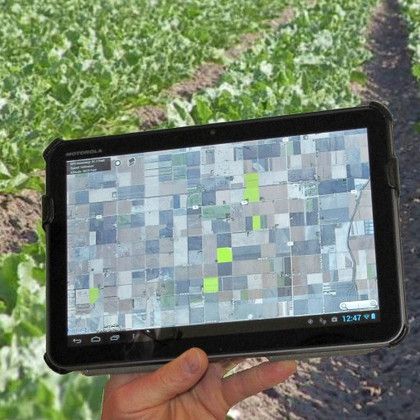
MapItFast and Strider Reporting keep you informed on the accuracy of the data you are collecting. When using the MapItFast application this information is displayed in the box in the upper left hand corner of the screen. Tapping on the box will bring up even more GPS details. When collected GPS data in Strider your accuracy will display at the time of data collection.
Tips to Improve GPS Accuracy:
- Device Position – If possible, position the device so that it is pointed upward with an open view of the sky.
- Make sure the location settings on your Android device are set to accept GPS satellites. Most Android devices have a High Accuracy setting which will use both GPS and WiFi (when available) for highest accuracy and fastest GPS lock-on times.
- MapItFast GPS Settings – Set the GPS settings in MapItFast to help assure accurate data collection. The following are available:
- GPS Accuracy MapItFast will use this setting to determine when data is accurate enough to be collected. The default setting allows the app to collect data anytime GPS accuracy is 80 ft (~24 m) or better. The lower the number, the more accurate the data will be, however you must keep in mind the average accuracy of your device’s GPS. If you set this number too low, your device may not collect any data if the GPS cannot obtain minimum accuracy.
- Minimum Distance This setting prevents unnecessary data collection while the device is sitting in a single spot. At the default setting, you must travel at least 10 feet from the previous line point or polygon vertex before another line or vertex will be logged. If minimum distance is turned off, MapItFast will continue to collect points at timed intervals regardless of the device’s location.
- Minimum Time This setting is the minimum time between line points or polygon vertices as they are drawn on the map. The default setting is one second. When logging lines or areas that have numerous curves, it is a good idea to use a small time interval to assure the vertices are being collected, especially if you are traveling fast. If this is turned off, MapItFast will collect points using the minimum distance setting.
Bluetooth GPS
Many of our customers are not aware that you can connect and use a Bluetooth GPS for data collection. A Bluetooth connected GPS will override the GPS on your device. This makes it possible to use a stand-alone GPS such as the Garmin Glo, Bad Elf, or SX Blue to improve GPS accuracy. The Garmin Glo will help you achieve an accuracy as low as 1-3 meters because it utilizes Russia’s GLONASS satellite network in addition to US network. The SX Blue is able to provide sub meter accuracy which is commonly used today with survey and hi-resolution navigation systems such as those found in agriculture and construction equipment.
We hope this post on GPS accuracy helps you with what to expect when logging data in MapItFast on your mobile device. Please contact us via phone or email with any questions you might have or assistance you might like on this subject.